3.11

1990 1999 2001 2002 2003 2004 2005 2006 2007 2008 2009 2010 2011 2012 2013 2014 2016

Introduction

JDW BASIS OF SELECTING THE 3.11 TSUNAMI DESTRUCTION RECOVERY:

JDW Basis of Selecting the 3.11 Tsunami Destruction Recovery:

Basic Inquiry: post-Disaster Assistance Initiative

Q: CONTINUITY?
Fishing Villages and the Sea - a Reciprocal Dependency
Lost: Lives and Entire Communities Perished
Futures Unknown, TBDetermined...

Q: TRANSFORMATION?
Who Will Live Here
What will rise from the Tabla Rasa
Next Relationship to the Sea

JDW Agenda/Actions:
A. Rapid Response Building of Temporary Gathering Place at Virtual Community Sites
B. Envisioning Paradigm Shift in Long-Range Community Planning

thriving 400+-year town of Minami-sanriku

3.11.2011 Disaster

津波被害に襲われた南三陸町

On March 11, 2011, a magnitude 9.0 earthquake occurred off the Tōhoku coast

The undersea megathrust earthquake triggered a massive tsunami that reached heights of up to 15.9 meters.

Seen here visualized by the JDW team on a building in Tokyo

The combined impact of the earthquake and tsunami caused widespread destruction along Japan's northeastern coast, resulting in over 22,000 deaths and missing people, thousands of injuries, and extensive damage to infrastructure and homes.

At the urging of MIT’s President Susan Hockfield soon after the tragic disaster of March 11, 2011 in eastern Tohoku, Japan, the MIT Japan Program launched the MIT Japan 3.11 Initiative. Faculty and students from across the Institute mobilized with seed funds and time. The Japanese Disaster Relief Fund of Boston provided the challenge grant to get the Initiative underway.

Directed by Shun Kanda with co-director James Wescoat, the initiative - along with the MIT Department of Architecture, Miyagi University, community leaders in Minaminsanriku, MIT faculty & students, alumni/ae of the MIT Japan Design Workshop - set out to extend a program of humanitarian assistance to the people of Tohoku in the rebuilding of their future.

With sustained support and active participation by the MIT community, with volunteers from around the world and in Japan, and corporate and institutional collaborators, the Initiative’s activities are intended to lend a strong hand in this long road to recovery.

Since the March 11, 2011 Tohoku Disaster, JDW joined with the MIT Japan 3.11 Initiative in recovery assistance at Minamisanriku, Miyagi-ken. The following sections cover the range of projects and studies that engage with the recovery effort.

A community and town's history washed away in one single day....as survivors watched in awe

from the surrounding hillsides...

The history of a place perished !

the 3.11 flood area delineates near identical extent and configuration

of the bay four hundred years ago ......

the sea had returned to take its claim.

Prologue

MIT 3.11 Japan Initiative
Team Arrives at Site : Summer 2011

“By the sea” or “inland” ?

For those who have spent all their lives next to the Sanriku coastline of eastern Tohoku, this question posed in the days after the disastrous earthquake and tsunami of March 11, 2011 became an overarching dilemma. For indeed, these were people whose lives were saved but whose homes, workplaces, schools, shops and their community perished overnight.


In the ensuing years of recovery, longtime residents relocated themselves to higher ground. Others moved to towns further inland where new employment could be found.

The government sliced out flat land from mountainsides for new housing construction. The culture of a community and its people tied to a centuries-old place had sadly disappeared.

[BEYOND 3.11_nx] :


What is amiss in the actions of the decisions-makers is the re-building of the social infrastructure - a

“Stage for All”

Projects

PROJECT 1: Babadoru 5-chome

Garden Pavillione: A Stage for All

Rin Rin Popolo: The Tale

The People

There are certain people in this village who are known as the local historians, kataribé or raconteur – folks who can recite anecdotes and local legends and who are very friendly especially to outsiders.

Scroll right >

It was just before the 2nd anniversary of the 3.11 Disaster that we met Kiyoko san. We had heard about her during one of our visits to Iriya. There are certain people in this village who are known as the local historians, kataribé or raconteur – folks who can recite anecdotes and local legends and who are very friendly especially to outsiders. Since the Japan Workshop last year, we had decided to understand Iriya through oral history. Kiyoko Yamauchi was one such individual. She lived in a large house in the hamlet of Hayashi-giwa (hayashi means woods). Hayashi, written林 – character composed of two trees, is also pronounced “rin”. Thus, 2 x rin = rin rin. Add “popolo” (Italian: people) > Rin Rin Popolo, the name given to our project.

The hamlet of Hayashi-giwa is full of families with the surname Yamauchi – the hundred-years-old extended families who still live in this particular hillside of Iriya. Kiyoko-san’s house was at the base of this cluster of Yamauchi homes so that relatives, friends would always pass by and stop by to chat with her over tea and snacks.

But after 3.11, things began to change.

The residents of this valley turned inward. Outside their homes, informal social gatherings declined.

Scroll right >

Iriya is one of the four districts of Minamisanriku. Located at some distance upland form the Shizugawa Bay, the tsunami of 3.11 did not surge up this far inland. It is a fact however, that Iriya did suffer collateral damage. Iriya residents who worked that day in the hospital, the town hall, the shops and schools of Shizugawa tragically perished. Kiyoko san’s husband had been taken ill several months before and had been under regular hospital care. In the weeks following 3.11, his supply of medical care and visits to the doctor was cut off abruptly. In May 2011, he passed away. The residents of this valley turned inward. Outside their homes, informal social gatherings declined.

Project Site

A conspicuous rock protrudes, standing strong and visible across the fields mildly sloping upwards.

Scroll right >

A conspicuous Rock protrudes, standing strong and visible across the fields mildly sloping upwards. A large chestnut tree looms from behind it, sheltering the rock at its southwest side. With your back to the rock, looking east, a magnificent spread of rice-fields swoop downward then up, toward the mountain tops far beyond. The rock is a dot in the landscape. But sitting by it, one feels a strong sense of orientation and the where-ness of this place. Iriya which literally translates as “internal valley”, is steeped in unusually rich local history.

Legends abound about people and events related to the nearby mountains, of valleys, ponds and rivers. There are huge standing boulders and characteristic rocks. Iriya is blessed with beautiful natural scenery, long loved and cared by its people, to this day.

A temporal setting with easy access, welcoming all passing beside it – a “Stage for All”, 「みんなの舞台」

Scroll right >

Our project would be a small gathering place set within these surroundings. A temporal setting with easy access, welcoming all passing beside it – a “Stage for All”, 「みんなの舞台. Physically small yet spatially very large, with a panoramic outlook extending way over to a world afar. Kiyoko san and her neighbors would enjoy the relaxing informality, the casual story-telling, the tranquility, a re-look back at their native land. We would build a small “porch to the world”, a hanging, aerial terrace anchored by the rock and the chestnut tree.

The Project

Up to 200 Bamboo poles and 400-meters of fisherman’s rope and garden twine. Bare-hands, two-hundred fingers. No power-tools.

The construction period: August 3rd start to completion on the 11th. Humid, hot summer temperatures, some days with fog, a bit of rain. Construction crew of students, volunteers, local experts.

The Team & Support

“All the volunteers from Tokyo, friends of the MIT 3.11 Initiative appeared and disappeared having contributed their expertise. Saya as the project coordinator dug in with her boots, tying the fisherman’s knots to bamboo while making sure everything was running smoothly, keeping count. This incredible team, none of us who had ever worked our hands with bamboo cutting, tying and assemblage, managed to bring the construction to a success! But not without some major support from others.

It must be said that at certain points in the construction, the team was almost powerless. Kiyoko san’s brother Kenichi san, and her eldest son Genichi saved us at crucial tasks – earth moving and stone hauling, which we alone certainly could not pull off. Yamaguchi san from Heisei-no-Mori on the other side of the mountain, and a seasoned carpenter, advised us with structural decisions and overall construction details. Miura san, a fisherman from our Baba-Nakayama days last year, stopped by as the expert instructing us with rope-tying.

Then there is Junko san and her four friends from Tokyo who were “paying a visit” but then immersed themselves into “heavy labor-work”, pitching in with anything that had to be done in the final days of construction.”

The Rin Rin Popolo project came into being on the 11th of August. It was the culmination of sheer teamwork, willing collaboration, and support from individuals near and far.

By the time that the group parted from this project scene, Kiyoko san seems to have already spread the word that she is back in business – just drop by for tea, a chat, and more story-telling.

Beyond 2020

NEED TEXT HERE THAT CONTEXTUALIZES THESE AS PROJECTIVE PROJECTS

The following sections show proposals...

Prologue for 2020

New Ecology at Ground Zero: Rising Sea


Proposal:
Restored estuarian wetlands for Shizugawa Bay - a return to the rising sea.

Scroll right >

An alternative vision for a revived estuary and wetlands eco-system underlies our proposed studies - a softer infrastructure where a slower economy and indigenous coastal culture may flourish, recalling its past only 400-years ago when these exact locations were bays and natural river deltas.

Scaling New Ground

Funicular, Sentiero and Route Ria
A Triad Mobility Paradigm

Hierarchy of a Triad Mobility Paradigm - S.Kanda/K.Schierhold 

At the dawn of Year 2020, this Sanriku region of Tohoku is enjoying an unprecedented new mode of mobility fundamentally different from the previous transportation paradigm. An alternative transportation strategy scaled to our demographic reality, to our geographic and topographic features of the ria landscape and utilizing 21st century technological innovation have been implemented. These include the Funicular, the Sentiero, and the Route Ria. These three comprise a linked hybrid movement network demonstrating a triad mobility paradigm - a new “soft infrastructure”.

“We ride the Funicular up and down the hillside where we live. The Sentiero path connects us to al the neighboring seaside villages. These two modes of mobility have given us so much choice and freedom in how to go about our daily lives. As many of us get older and less able to drive a car, we realize the importance of having alternative access to self-reliant mobility. The on-demand and autonomous smart cars traveling on the Sentiero are so convenient that our days of isolated lifestyle are now fortunately in the past.

The Route Ria has replaced both Highway #45 and JR Kensennuma railroad line which were severely destroyed by the 3.11 tsunami. Route Ria is our new highway connecting to destinations further inland from the coast. Safe from the reach of tsunami, this highway serves as a critical escape and disaster rescue route in the event of future catastrophe.”

CAPTION: The Funicular with a View to the Bay and Pacific Ocean Beyond - S.Kanda/K.Schierhold 

The Funicular

The Funicular is the most local transportation amenity traveling on the hillside connecting the waterfront and the higher residential ground. To live on the slopes of Shizugawa Bay requires easy access on the hillside. And, a mobility system serving many diverse functions important to our everyday needs - shopping at dei Popoli, commuting to school, visiting eldercare or the media center, and going to work.

We depend on the funicular for the delivery of mail and packages, household cargo and emergency medical services. At times of disaster, the funicular will serve as an evacuation route and important lifeline.
In the years following 3.11, the building of new homes began after the Funicular was completed. Residential development branched out horizontally following the hillside contours. Each funicular station became a nodal gathering place where neighbors stopped to chat and rest. We check the schedule on our smartphone and walk a few minutes from our home to the stop. There is very little climbing on the pedestrian path which has made carrying baggage easier for everyone and accessible to wheelchairs, baby carriages and the handicapped. In some areas, a kids’ playground or a neighborhood vegetable garden have been found at the other end of these residential walkways to the delight and enjoyment of all.

The funicular is a panorama spot in motion. Views from within extend in all directions to the ocean’s horizon. One cannot help to hold the sights in wonder and appreciate the uniqueness of place we now live.

We feel this palpable sense of home, living so close to the sea. Today, with a relative visiting from Sendai, we ride the funicular to dei Popoli which is now the center of our community.

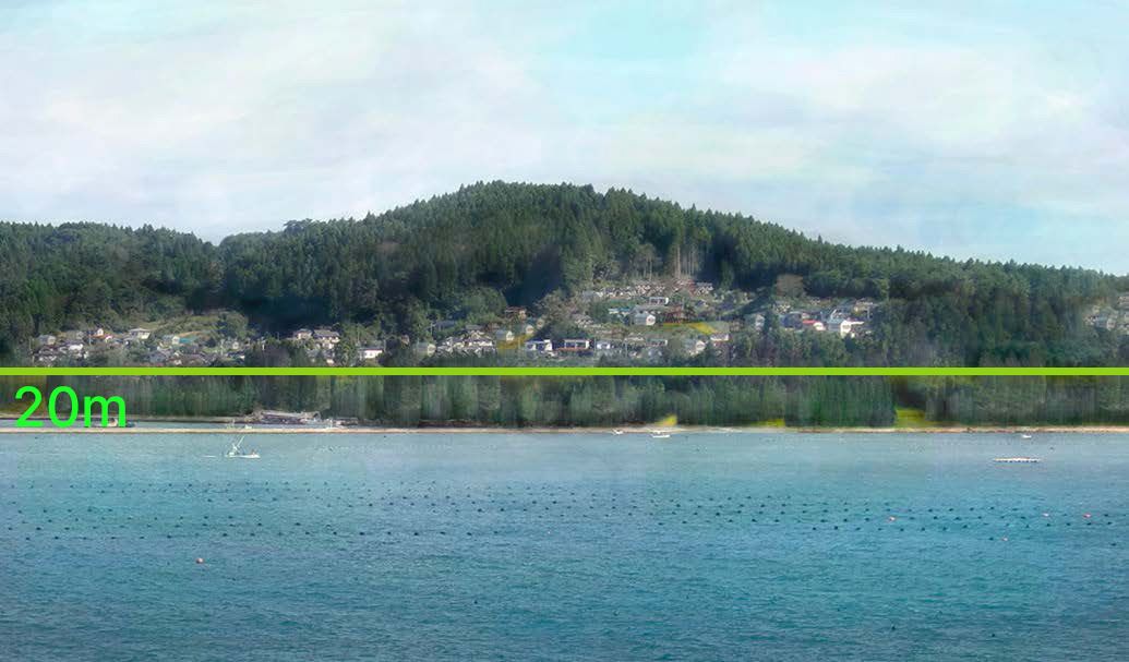
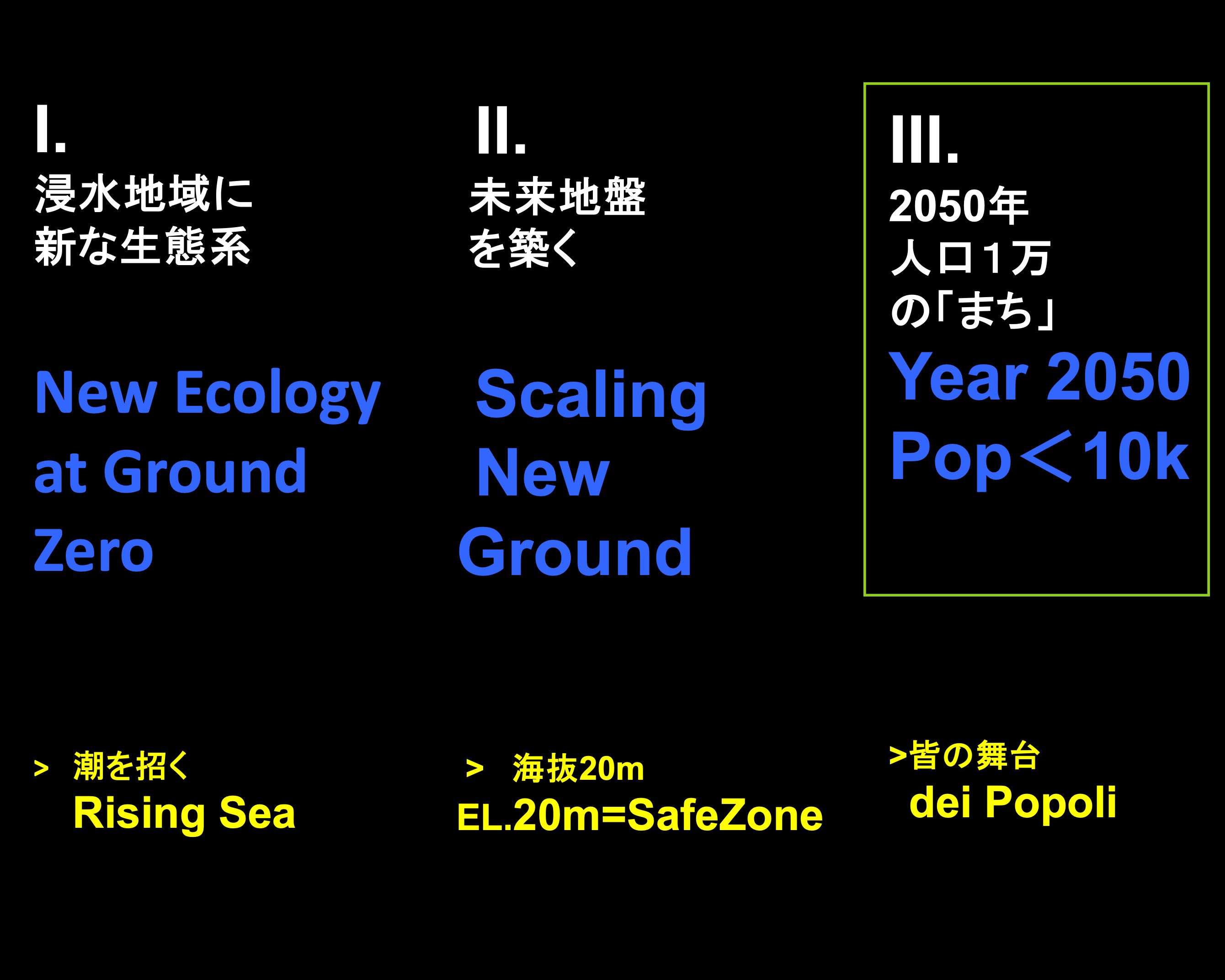
The Coastline Sentiero at EL 20-meter above Sea Level - E.Lo Gibson

The Sentiero

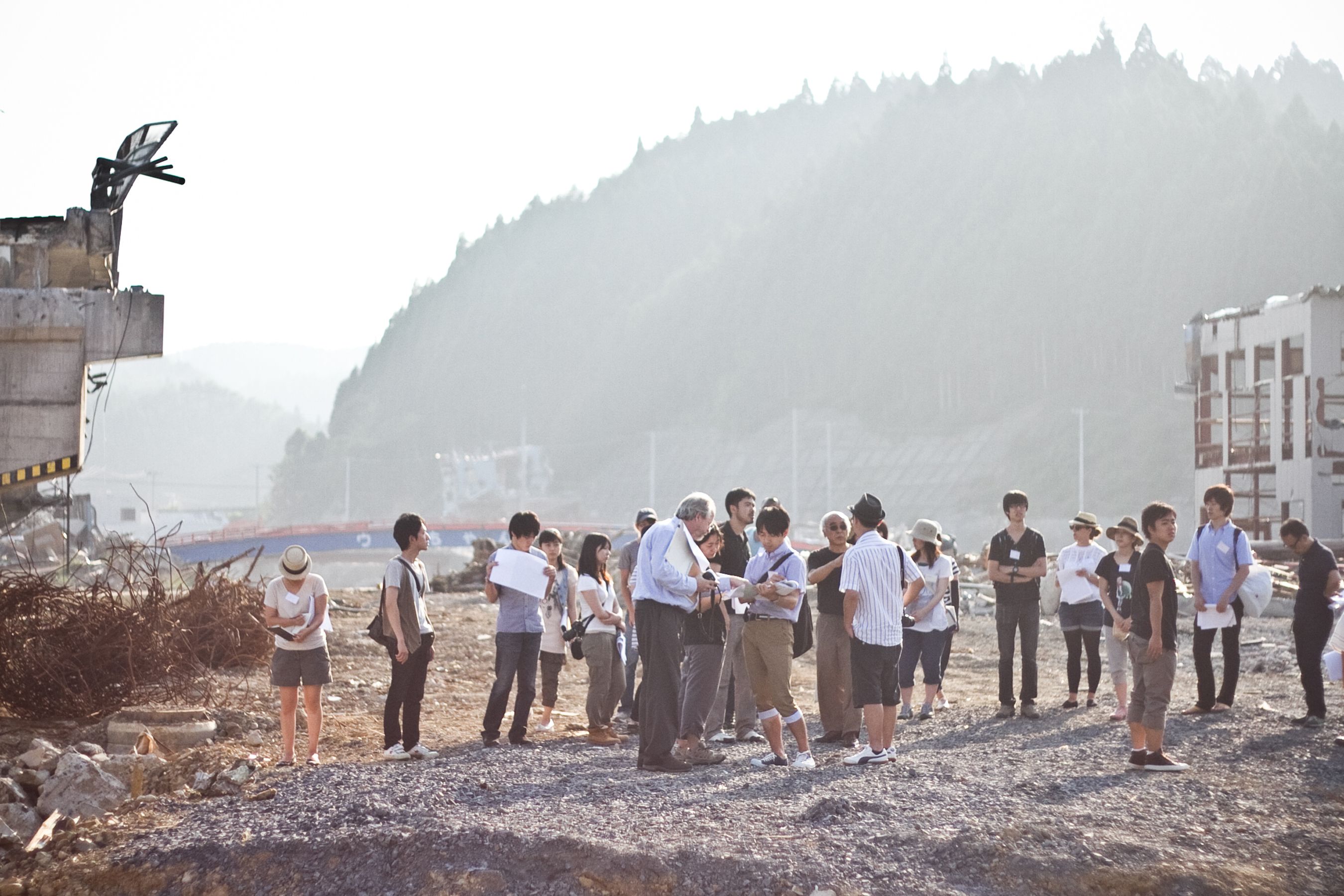
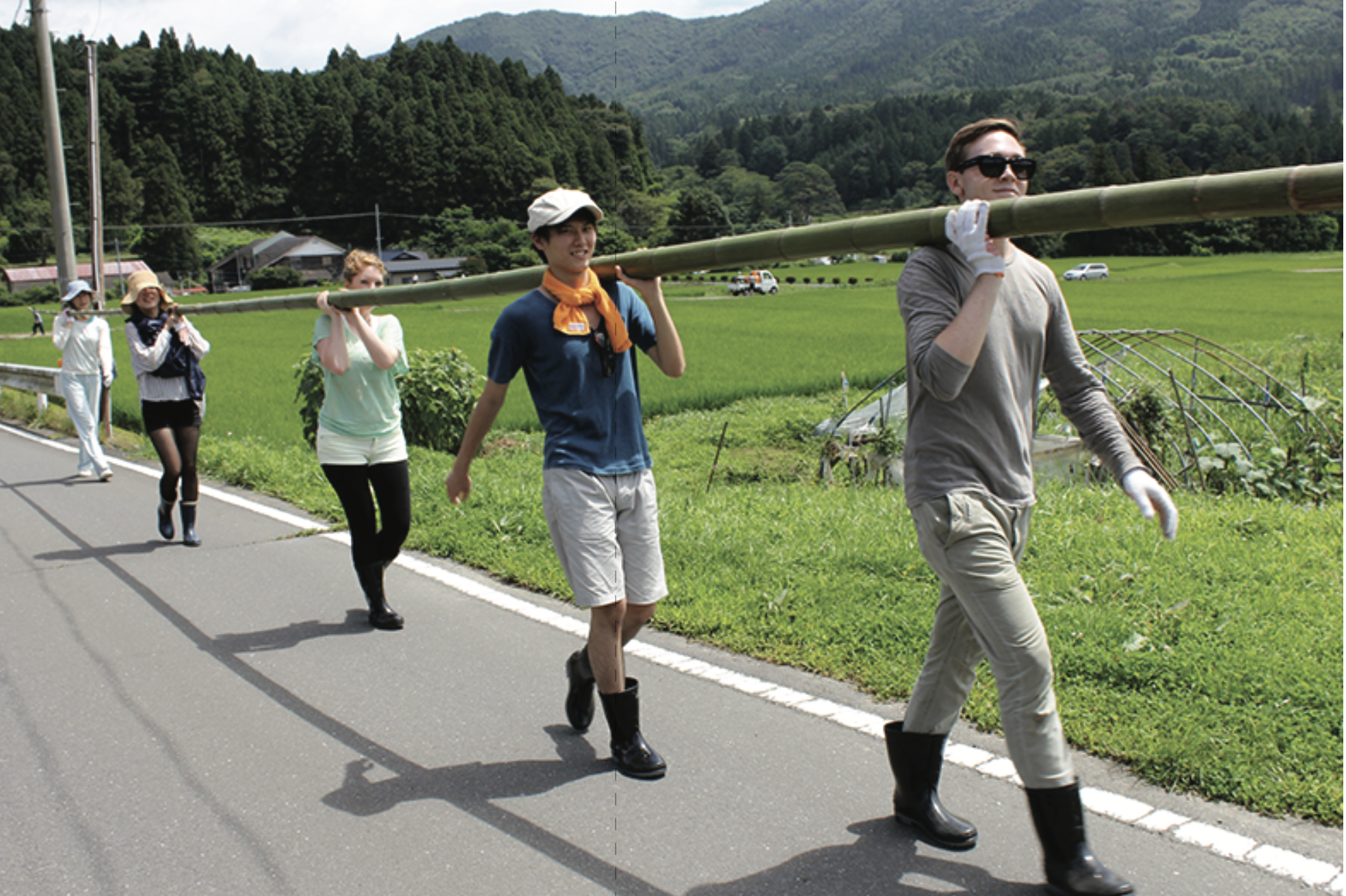
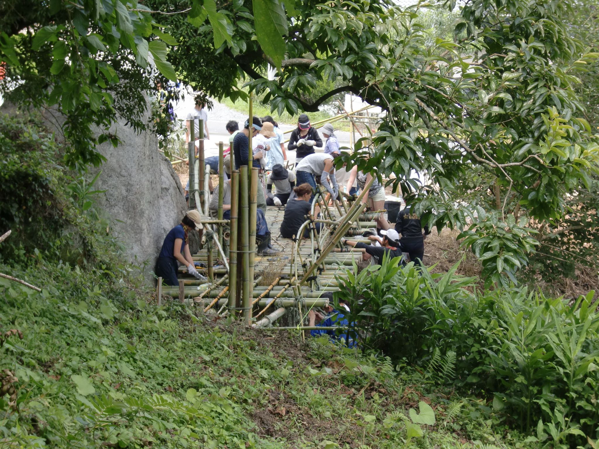
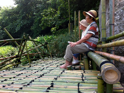
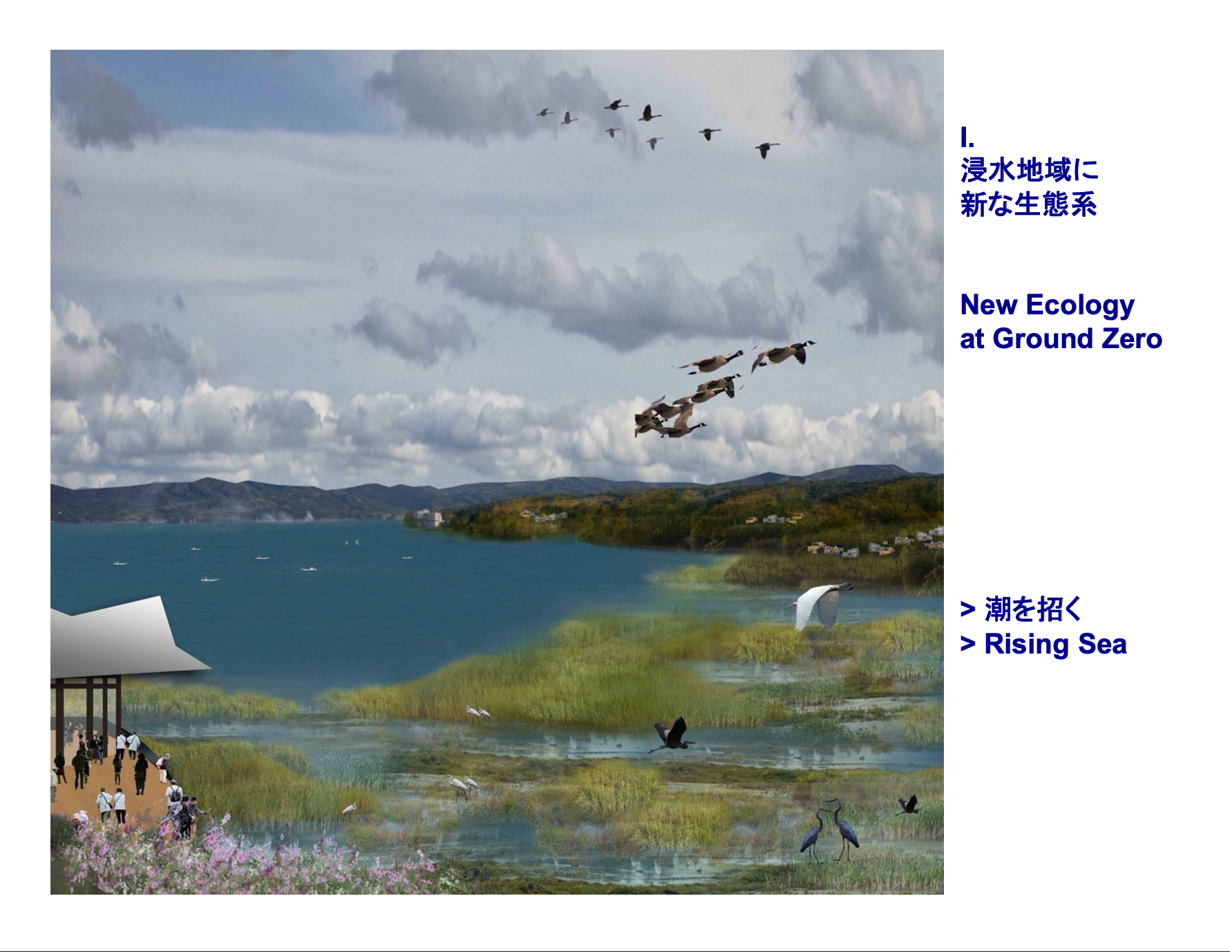
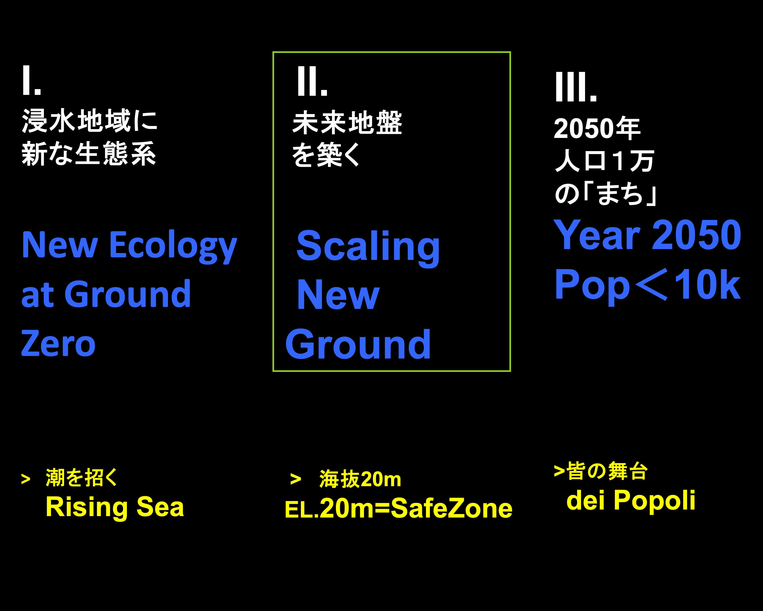
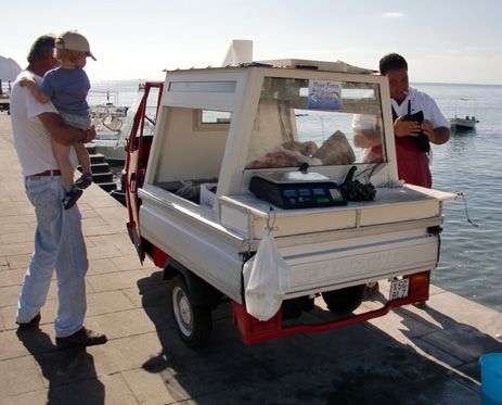
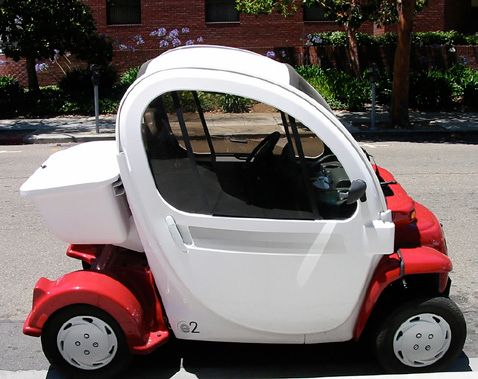
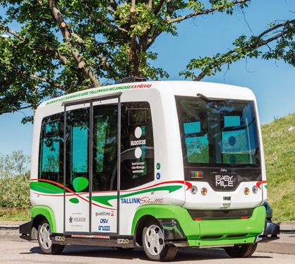
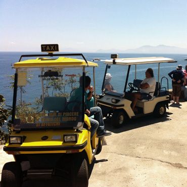
The Sentiero is the second of the triad mobility paradigm. It is our country backroad used by smart cars and by people who are walking, jogging or bicycling between the neighboring villages. The elderly, school-kids and teenagers, family and friends, farmers, fisherman, slow-tourism hikers – all seem to enjoy and share the Sentiero. Located alongside the scenic coastline, the Sentiero is also a a very popular nature trail.

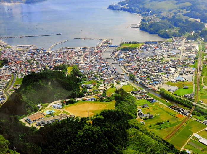
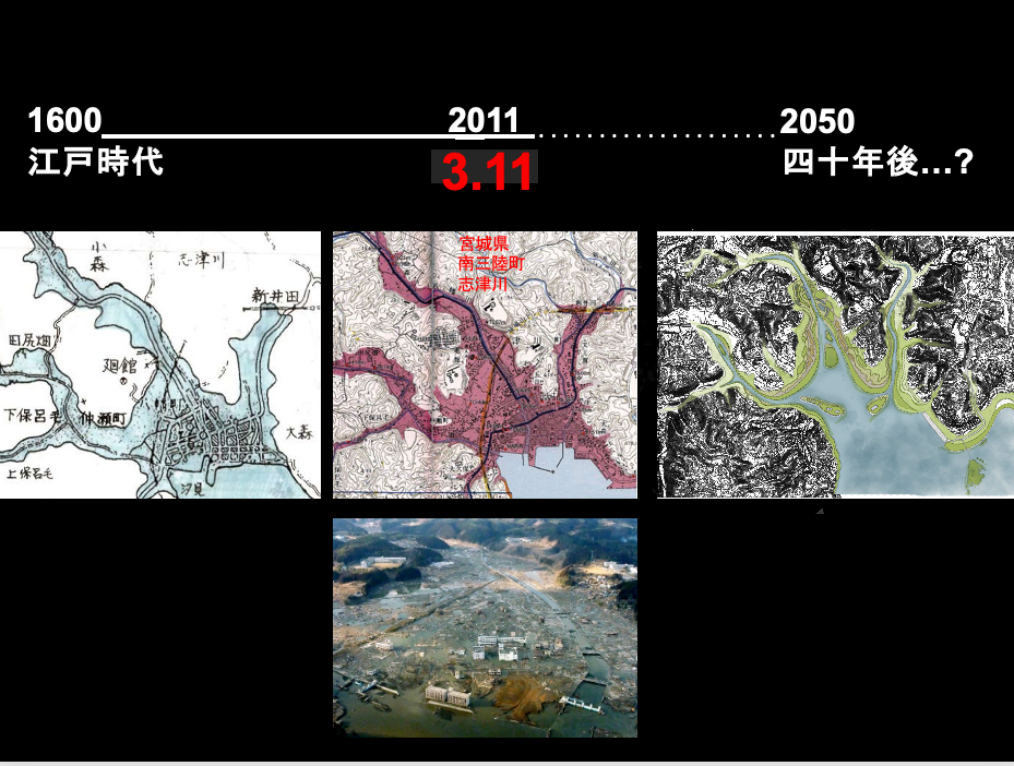
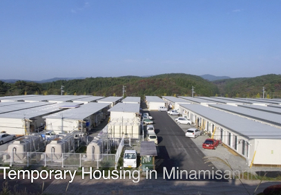
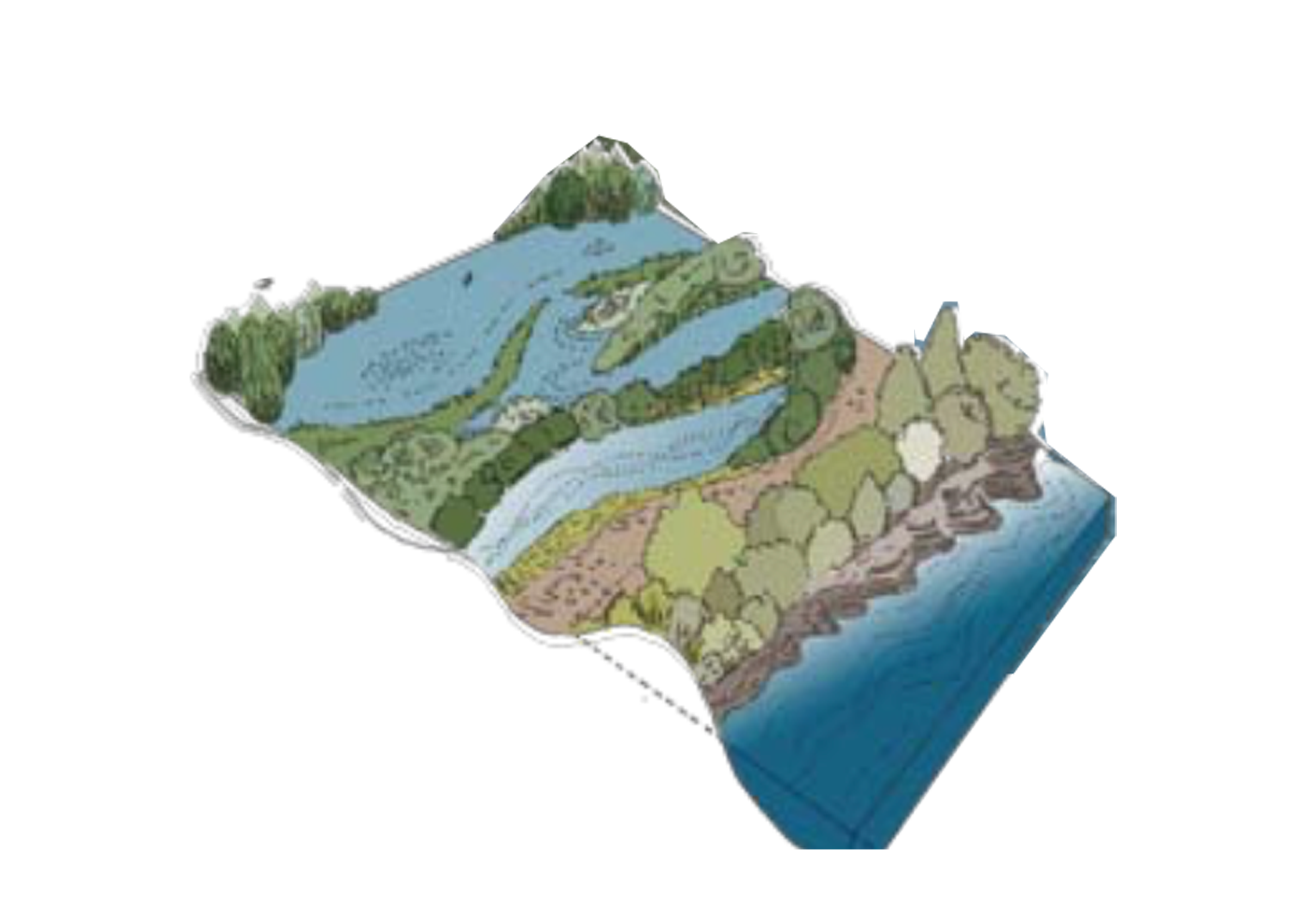
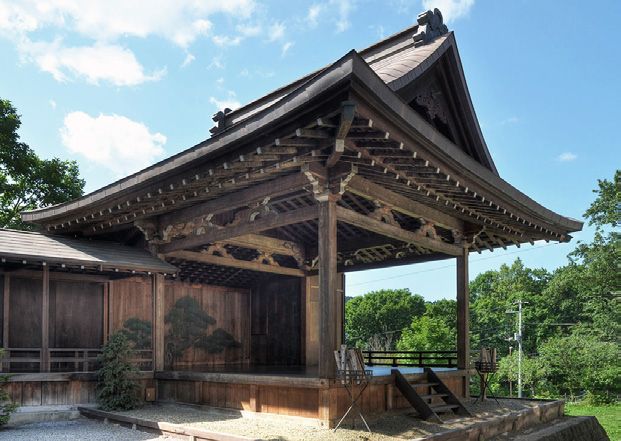
At Minamisanriku, the Sentiero is a corniche meandering through forested slopes and furrowed valleys, hugging the cliffside where deep inlet villages and hidden bays open to the Pacific. This route is not new. There has been a footpath for a long time which connected the more than two dozen fishing and farming communities along the rugged mountainside. In combination with the JR Kesennuma railroad, these routes at one time were well-traveled familiar paths of mobility for our region.

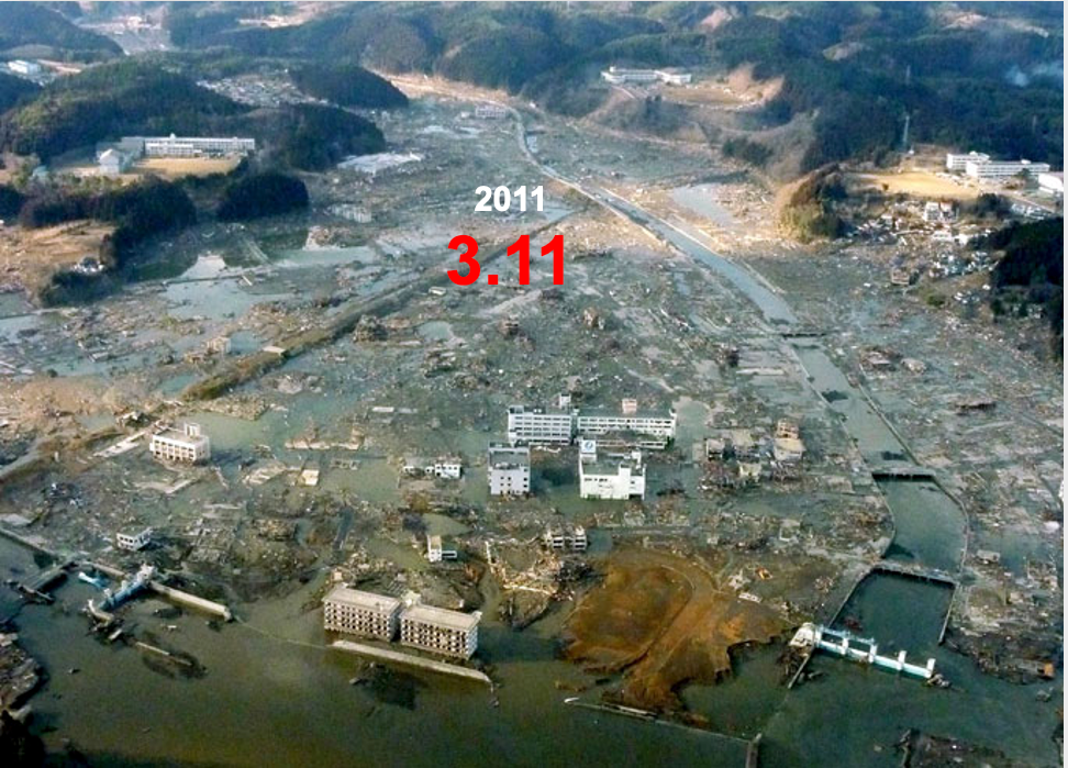
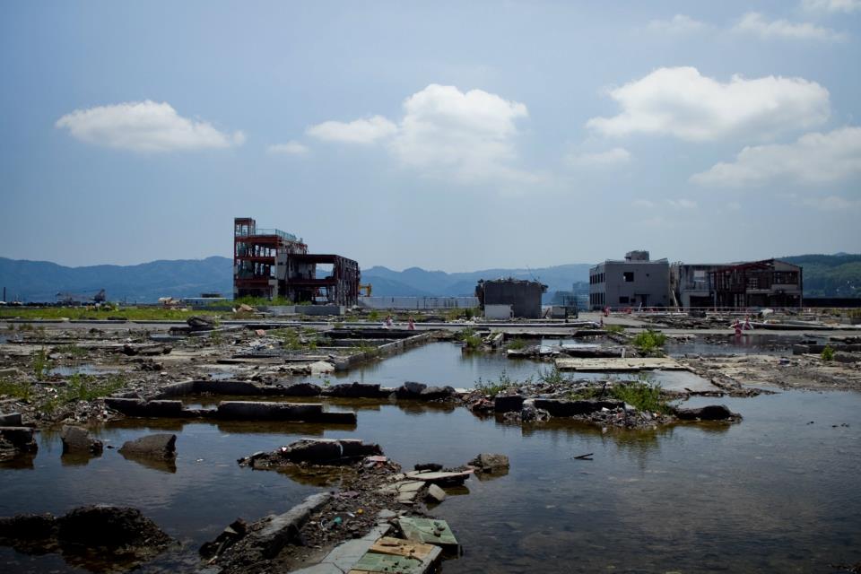
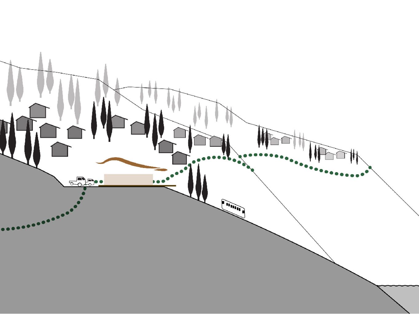
In post-3.11, the Sentiero had once again regained its vital role for us, particularly in strengthening the social benefits derived from locally integrated transportation. We had always felt the anonymity of Highway #45. Drivers sped by affording little face-to-face contact or exchange. In contrast, country backroads promote casual social interactions. Undisturbed by faster moving traffic and at a safe elevation above sea level, this scaled-down road has become a great asset for promoting a close-knit social fabric suited to our current downsized population.


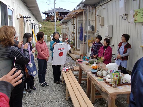
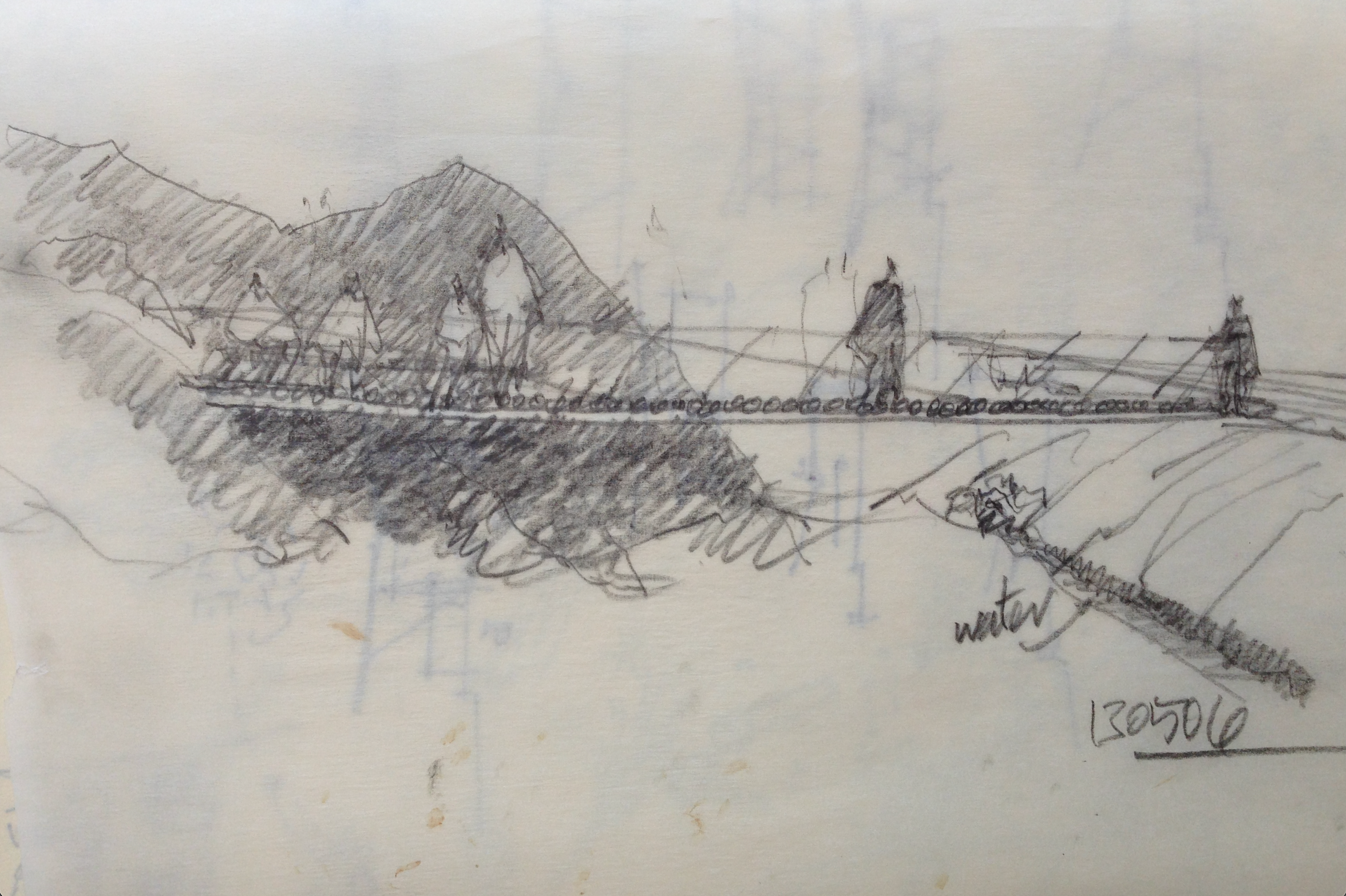
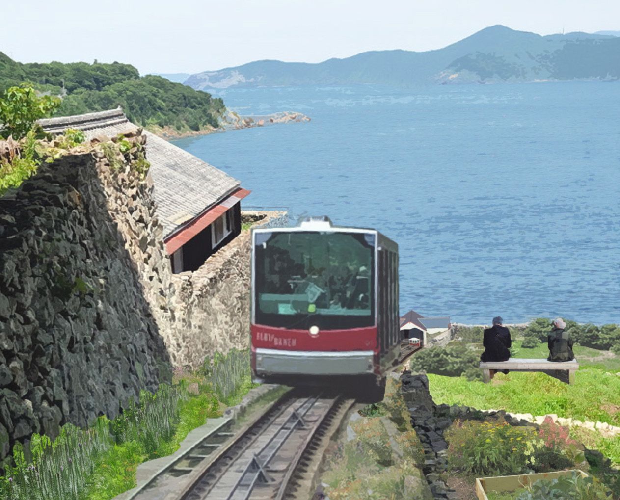
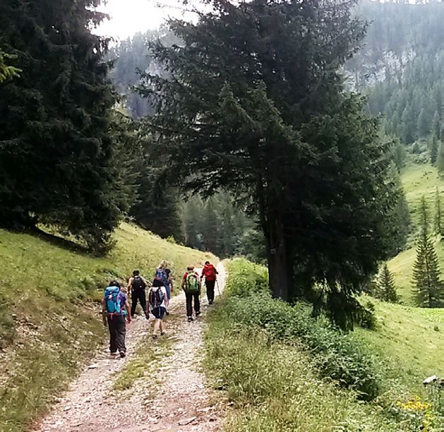
Image of Sentiero - Allegre Marmotte 

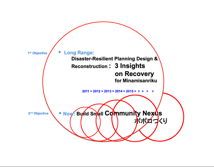
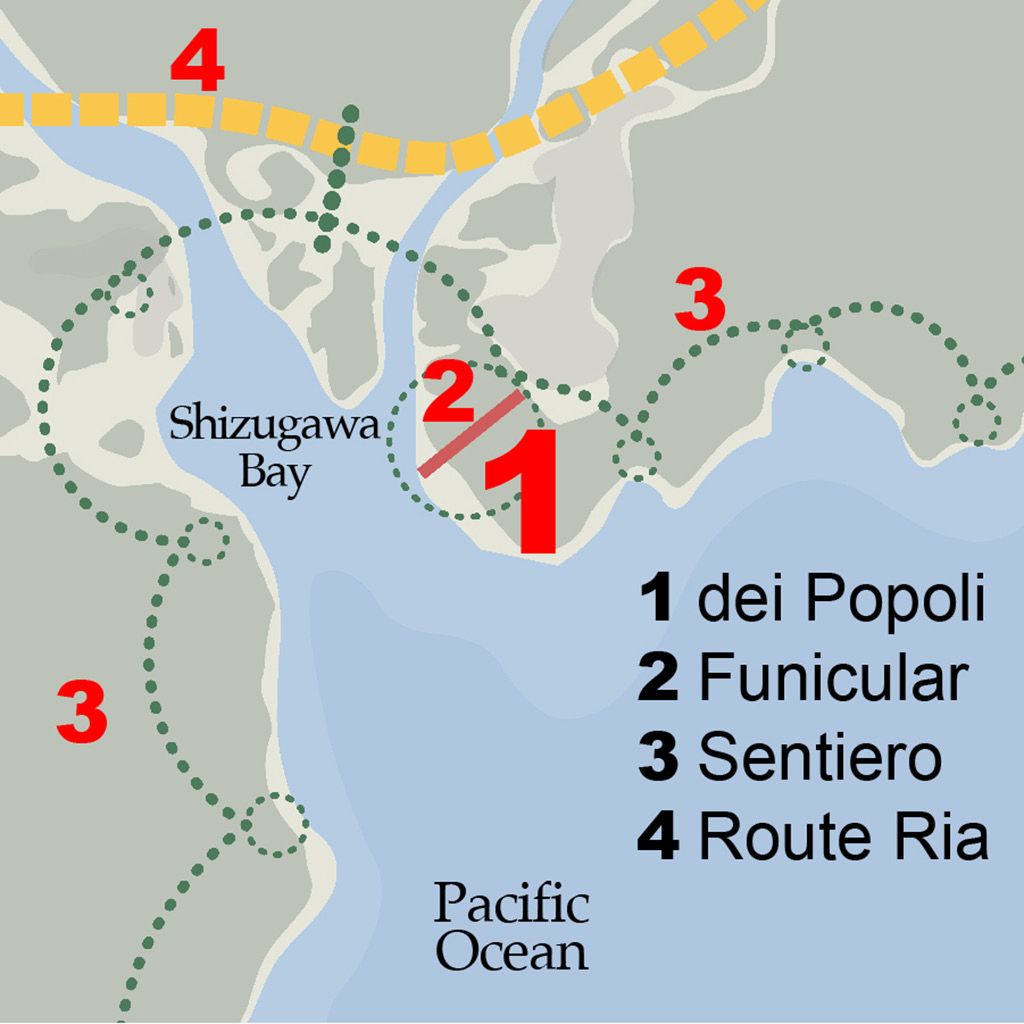
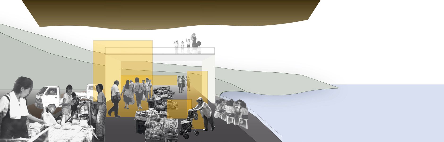
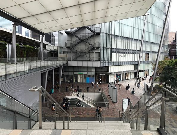
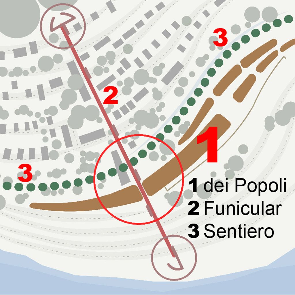
The Sentiero intersects the Funicular at dei Popoli. This is the nodal crossing point between the hillside residential community to other coastline villages along the Sanriku seaboard. From here via the funicular, one can descend to the waterfront for water transport as well, to take a ferry boat south to Ishinomaki or Rikuzen Takata to the north. In another discussion, it would be interesting to consider the possibilities of a “sentiero on water” for the region.

In this way, multiple transport systems linked at appropriate scale managed and used by the local population, become important catalyst of building a future beyond 2020. The key to these transportation innovations lie not so much in larger top-down funding but rather from thoughtful regional strategies which over time underscores the bottom-up, reality-based improvements to our everyday lives.

Traveling by smart cars or hiking Sentiero’s scenic routes, people are finding more opportunities to spend time at their own pace savoring their own experience of locality. In fact, the region’s vital tourism economy is once again booming. And in turn, for the people of our region, we feel a satisfying pride of place.

Route Ria

Route Ria is the region-wide transportation component in the hierarchy of the triad mobility paradigm. It is in effect what used to be Highway #45 except that the reconstructed route is located entirely inland. Perpendicular access roads from Sentiero branch away from the coastline to link up with Route Ria. This highway transports people, goods and services from the coast to the central exchanges of Tohoku and beyond.

Highway #45 appeared in Minamisanriku in 1972 during Japan’s accelerated construction boom. Engineered highways, dams, river escarpments, seawalls and cemented cliffsides transformed our natural environment everywhere. Our Highway #45 connected regional services well but at the expense of local communities. It propagated disruptive through-traffic. The highway’s presence created solid barriers cutting a town’s direct access to the waterfront. For small towns along the Sanriku coast, Highway #45 introduced an out-of-scale automobile-centric society and drastically changed our daily lifestyles and physical environment.

Route Ria has now replaced Highway #45. We have learned to downsize our transportation needs by implementing a hierarchical system. A small town with a slower-paced post-3.11 lifestyle does not require a national highway running through its center. A single regional highway has been broken down to a triad mobility network. This paradigm shift introduced a scalar concept which first preserves the identity and quality of locality. The hillside Funicular demonstrates such a system. Then the Sentiero route is linked as the intermediate scale of mobility which preserves the tranquility and beauty of the mountains, valleys, and the sea surrounding us. Then finally, access to Route Ria which connects us to the rest of Tohoku and beyond. It is also our ultimate evacuation route in times of major disasters.

For those of us living in decentralized towns of regional Japan, a sustainable and resilient future for the next generations relies on an advanced transportation system but also on a renewed paradigm wisely based on appropriate scalar implementation. In this discussion of our triad mobility paradigm, let us conclude with two real-time episodes from the tragedy of 3.11. They remind all of us about the relevant and ultimate lifeline concerning transportation and community resiliency.

Images of Smartcars for Diverse Functions and Transportation Technology

Survivors of Utatsu in Minamisanriku tell the vivid story of how on the third day after the tsunami had destroyed their homes, rescue came from above. Highway #45 which was the single transport spine of the town had perished. The first responders flew in by helicopter, having seen the huge SOS marked on the ground at Heisei-no-Mori athletic field where survivors took refuge. A note scribbled on paper dropped from the sky stated in English “what do you need?”. They were pilots from a U.S. Navy aircraft carrier stationed offshore in the Pacific. A list was sent back up, and in the following days, the requested items were dropped down to those waiting below. Disaster response did not come by land but from the sky.

In the fifteen hopeless days following 3.11, the survivors of Baba-Nakayama had taken refuge at their small community center upland from their homes which had been swept away by the powerful tsunami. Help arrived painfully slow. Desperately lacking drinking water and food supply, they found themselves utterly stranded. Access to Highway #45. was practically impossible, their ports lay shattered, and communication was cut off. How aid supplies eventually reached the four dozen survivors was all due to a single K-truck.

Damaged but not completely, the village leader and his son managed to repair their vehicle to start its engine. Cutting a path over inundated debris, passing by devasted sights of homes and friends who had perished, and maneuvering as would a 4WD all-terrain jeep, the daring son reached the town’s disaster relief center, retrieving whatever could be loaded with rice, water, blankets and other essentials. It took nearly a whole day for him to return. Until official rescue finally arrived at the scene, this single K-truck made its invaluable daily roundtrip mission where larger vans and trucks could not get through. Baba-Nakayama had endured, thanks to the K-truck!

Year 2050 Pop<10k

Dei Popoli
a Stage for All

Image of dei Popoli without Solid Walls - S.Kanda/K.Schierhold 

It’s our new landmark visible from everywhere. The large roofline extends parallel to the shoreline. Reminiscent of temples found throughout Japan, this roof appears prominent as if protecting the community around it. We call this our dei Popoli - a Stage for All. Overlooking Shizugawa Bay and the Pacific Ocean, dei Popoli is a public terrace. Its functions are multi-purpose and open to everyone – it is the commercial and symbolic center of our revived small town.

The dei Popoli is a building without solid walls. There is the roof and the ground. It may be analogous to the form of a traditional Noh-dance stage in the forest, or at a grander scale, the floating balcony at Kiyomizu-dera in Kyoto. Or similar to the linear roof at railroad platforms or the iconic canopy of Yaesuguchi at JR Tokyo Station.

Noh Stage without Walls - Wikipedia/Komatta 

Noh Stage without Walls

Kiyomizu Temple Balcony - S.Kanda

Kiyomizu Temple Balcony

JR Station Tokyo Canopy - S.Kanda 

JR Station Tokyo Canopy

Between the roof and ground are free-standing prefabricated modules built for flexible and temporary functions. Gradually over time, a visitor center, shops, a media center, public bathhouse, daycare and healthcare facility – all can be located under the big canopy. The dei Popoli is strategically sited on the mountainside 20-meter above sea level providing a unique panorama and shelter at times of disaster. On the mountain side, there are access points to the funicular and the local country road called the ‘sentiero’. Our weekly open markets and the seasonal festivals take place at this community crossing.

The fundamental concept of dei Popoli is that it is foremost an “event-stage”. A particular location that is spatially available to be occupied by “performers”, who are the people of the community themselves. Karaoke literally means “empty orchestra”, a musical space to be freely filled in by the voluntary singer. Similarly, dei Popoli is “empty stage”, a generous space accommodating all sorts of performing actors. The audience, the spectators and the guests are all attendees as well as reciprocating performers. Hence, the stage is borderless. Its boundary is porous, not sharply defined. It is physically ambiguous and welcoming. The large roof overhead simply suggests a territory, a zone of activity – a stage for all. In this way, people come to regard dei Popoli as an event, less as an object. Nor is it a building such as the typical community center whose walls, and closed doors restricts who and what may occur within. It may be said that dei Popoli is an experience, an occasion in the collective life of everyone.

The Crossing of Funicular and Sentiero at the dei Popoli with the Residential Neighborhood on the Hillside - S.Kanda/K.Schierhold

The Crossing of Funicular and Sentiero at the dei Popoli with the Residential Neighborhood on the Hillside

Our dei Popoli is alive with activity from early morning to night, all seasons all year, bringing familiar faces together. It’s easily accessible and our day-to-day needs are mostly found there. Some perhaps come to meet friends or just to stroll and wander. There is a 3.11 Memorial just below the terraced promenade. The synergic scenario is animated by the dei Popoli being a “hub”, situated at the crossings of people, information, mercantile exchange and transportation paths. It is our market, our shopping arcade, our community forum and public gathering space. It brings together our hillside residential neighborhood to the waterfront. Friends from nearby villages and visitors from afar converge to our dei Popoli. It has certainly become the exciting center of our community.

Conclusion

3.11 Participants by Year

2011

2012

2013

2014

2016

Next Book:

Tokyo 東京参道